MobileAtlasCreator - OnLine resource maps
Instructions taken from http://www.androidmarket.czTo prepare (download from online sources) a map on the computer we need to use Mobile Atlas Creator (or Mobac, formerly known as TrekBuddy Atlas Creator). This program can be downloaded for free here. And here is the same with more map sources.
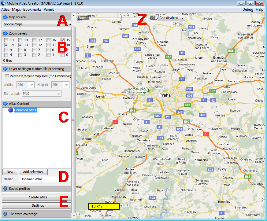
(A) After starting the program in the left column, select the map data that we can use. Map is available a lot, in the Czech Republic and the Slovak Republic but you will do the following:
- Google Maps - classic universal maps, which you probably know from the internet
- Google Hybrid - Satellite images with captions
- Google Terrain - field maps concentrating on mountains and lowlands
- Cykloatlas - best maps for hikers and cyclists in the Czech and Slovak Republics, I particularly recommend the version with relief
- Freemap Slovakia - if you are going to Slovakia, try these hiking, climbing or cycling maps

After selecting the ideal maps, select the area you want for creating your map. Right click on your mouse to move the map, the left button will mark the area.

The important part is to select the layers you want to save from the maps. It is actually an approximation, which will be available in the map. You can select layers in the left column in the Zoom Levels (B). Your decision can be aided by the zoom indicator at the top left of the map (Z), where the value is the zoom level, which is the same as the numbers in Zoom Levels. Always choose the layers with regards to the size of the area selected. (For example: a bicycle map of Prague with a magnification of 15, 14 and 13 has a size of about 30 MB).

Then go to the Atlas Content box below. Click on New (D), type the name of the atlas (eg Prague, Doupovské mountains) and choose TrekBuddy tared atlas. A new item should appear in the window (C). This is a new atlas with the chosen name, now it is necessary to add a map, which is done by clicking the Add button Selection.


Now additional maps can be added to this atlas (select new map layer and click again on the Add selection). In this case it is advisable to also rename the individual maps (right click on the name, select Rename, type a new name and press Enter).

Once everything is ready, click Create atlas.

This starts the process of downloading and creating maps. When it is completed (this may take some time) the maps are ready to move onto a mobile.
